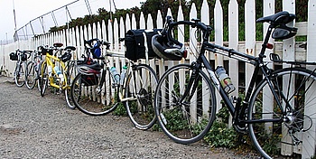
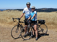
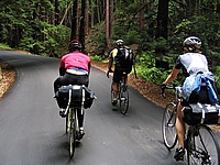
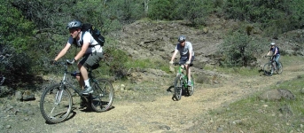
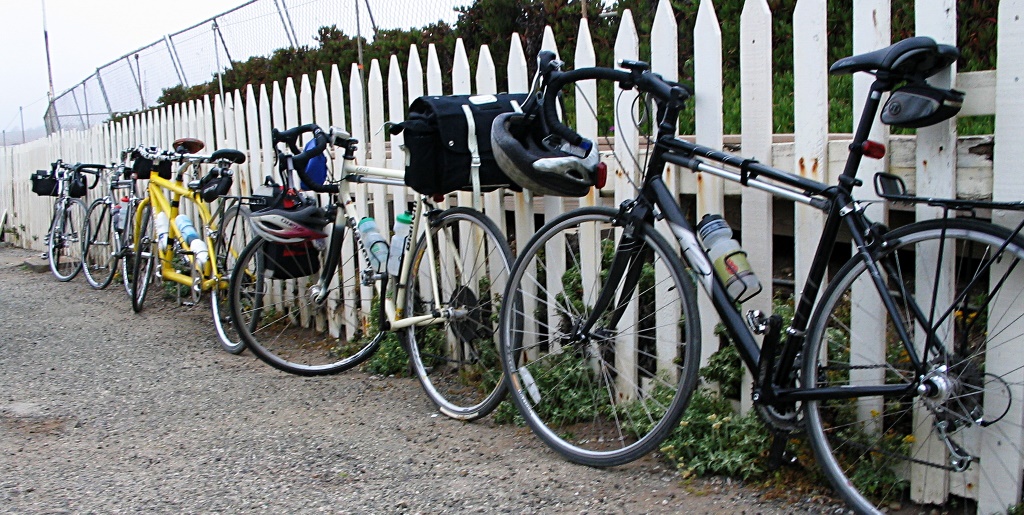
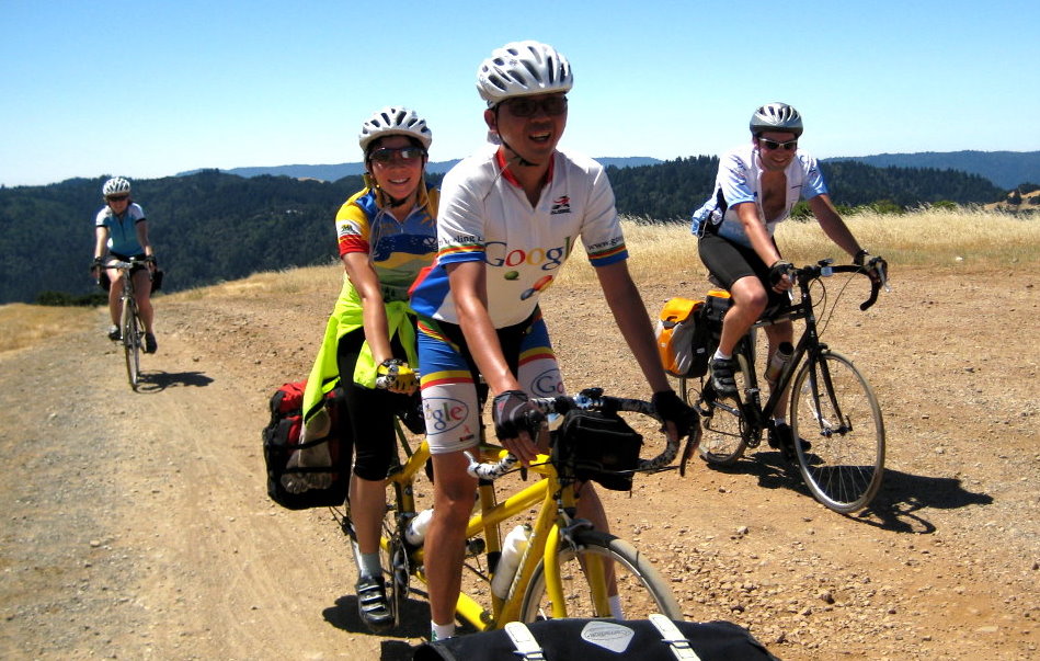
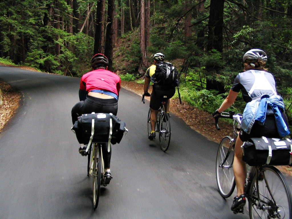
The weekend after our Point Reyes trip, Yana and I did an overnight bicycle trip to the Pigeon Point Lighthouse. We wanted to join a friend from work, Piaw, on a 3-week cycling tour of Japan which he was organizing at the end of the summer. Every year before he tours, he organizes a prerequisite shakedown ride so we were joining him for that. Pigeon Point is his usual destination for these shakedowns. It lies on the coast between Half Moon Bay and Santa Cruz, about 50 miles from Silicon Valley, and there’s a youth hostel (with a hot tub overlooking the Pacific!) so it is an ideal destination for an overnight bike trip.
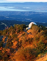
 The hostel is quite popular (at least during the summer months) and we were only able to get reservations for Sunday night. It was forecast to be hot in the valley on Sunday so we got up early. After meeting our friends there were some last minute gear adjustments (mounting extra water bottle cages, for example) before we departed. After leaving Sunnyvale, we rode out past Steven’s Creek reservoir, then up Montebello road. By the time we reached the climb the sun was high enough to be warm. Montebello starts out steep as it leaves the reservoir, then gets a little more gentle once it approaches the top of the ridge. When we reached the end of the pavement (Piaw likes finding dirt roads to ride on), the sun was hot. The 2-track dirt fire road goes right over the top of Black Mountain and we pedaled along, baking in the heat as we crunched through the dusty gravel. The rolling hills were covered in dry grass, being bleached by the sun. I had already finished two full bottles of water before we reached the top. Fortunately, on the other side of the peak, there’s a lonely drinking fountain next to someone’s driveway. I don’t know who the kind landowner was who provided such an oasis, but we were certainly grateful as we stopped to refill our water bottles.
 Having crossed the mountain, we had a long descent ahead of us down Alpine road. Everything was hot at this point; my brake levers and handlebars felt warm to the touch. The air was hot, and dried out our eyes as we sped down the hill. The road descended down the spine of the hill, playing with the steep ridge, first on one side of the ridge, then crossing to the other side, occasionally winding around a small hill then back to the ridge. On either side the grass-covered hill dropped away sharply and riding felt like flying as we banked around corners with the landscape far below. Each turn offered views of broad vistas when we were able to glance away from the road. It is a curse of biking that on the way up the hill you are too oxygen-starved to enjoy the view, and on the way down you are going too fast to look away from the road. (Of course, one could always ride slower, but that thought rarely occurs in the moment). About halfway down the hill the road made a sharp right turn and dropped off the ridge, plunging into the trees. It wound its way down to a creek at the bottom of the steep, wooded valley. The road here was narrow, without a centerline, and the corners were tight. After the sweeping vistas above it felt cramped, the riding no longer felt like soaring. The corners demanded attention and plenty of braking.
We regrouped at the bottom of the hill. Having already conquered the main climb of the day, we only had a few smaller hills between us and the ocean. The air was already cooler here, and much of the road was through the forest. We rode on to the small town of Pescadero where we stopped for lunch. 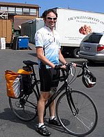 The market sells wonderful garlic artichoke bread fresh from the oven. We bought two big loaves, still warm and moist in the middle, and enjoyed them at the picnic tables on the lawn behind the store. This close to the ocean, the air was chilly and over the course of the meal we moved out from under the shade of the table’s umbrella to recline in the sun on the grass. After our meal, we returned to the store for groceries for the evening’s meal. We picked up pasta, two more loaves of half-baked bread (we would finish baking them at the hostel), and a fresh pie. All the food was stored away in saddlebags and paniers, except for the pie. It was delicate, but since Piaw and his girlfriend, Lisa, were on their tandem bike, Lisa was able to hand-carry the pie as we rode.
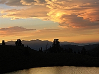
We left Pescadero via Cloverdale road, a lovely little road that heads south through a small valley, paralleling the coast. Although we had seen that there was fog closer to the water, Cloverdale road was one hill inland and that was enough to grant us sunshine. After several miles of rolling past fields, the road got narrower and met up with Gazos Creek road to wind along the creek bottom until it dumped us out on Highway 1 at the ocean. The weather here was overcast and windy; cold. 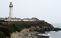 It seemed a world away from the dusty, dry heat we had been in just a few hours before, only 50 miles away. We had a brisk headwind as we backtracked a few miles to the lighthouse. After checking into the hostel, I explored the beaches by foot. North of the lighthouse was a long beach being pounded by the waves and wind, but south of the lighthouse there was a quiet cove, with stairs down to it. I had brought a swimsuit, so I went in for a very (very) brief swim. Although I would have enjoyed the freezing water earlier when we were roasting in the sun on top of Black Mountain, it was much too cold now that the sun was gone. I got my head wet and then stayed out of the water until we hit the hot tub after dinner.


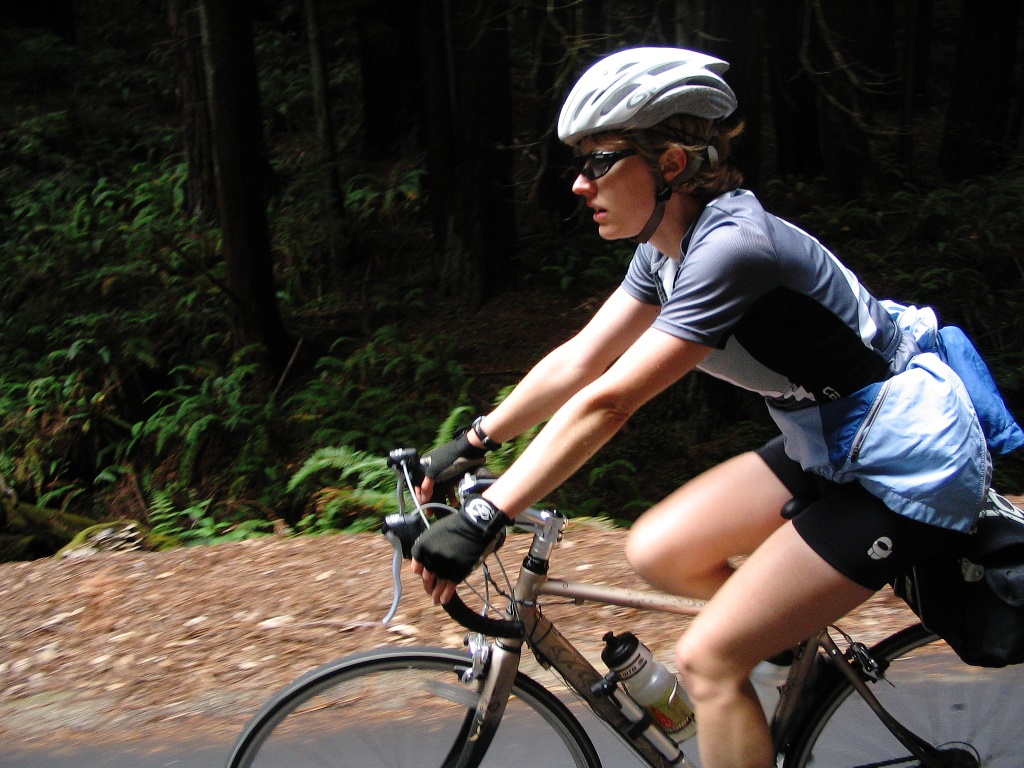
Monday morning we got up early because we had a long ride in to work. It was cloudy and cold as we rode north along the coast, cutting inland to ride through the rolling hills and farmland. Our goal was Tunitas Creek road, a beautiful climb up a ravine in a dense redwood forest. Redwood trees are magnificent in grey overcast weather like this, and the temperature was great for climbing.
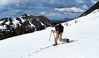
 Even though we had only been gone one night, I still had an odd feeling of independence as we rode in to work. It was similar to what I had felt the previous weekend, on our Point Reyes ride. There’s something about traveling by bicycle: knowing that you’re carrying whatever supplies you need and that you have the freedom to ride wherever your legs can take you.
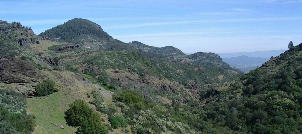
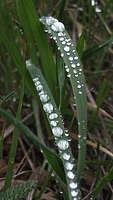
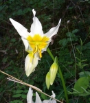
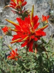
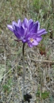
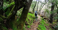 It’s springtime and flowers are coming out! To celebrate, we went hiking at Henry Coe last weekend. The park is at its most beautiful this time of year, with green hills and lots of flowers. The weather was cool (bordering on cold) and a little damp. There was dew on the grass & flowers and it lasted all day in the shade.
 We went in from the main entrance and hiked to Frog Lake, along the Monument trail. I really like the top of the Monument trail. There’s a spot where the hill opens up and has some tall pine & oak trees. It was very quiet except for the wind blowing in the trees. From the top, the trail descends down to Frog Lake. Anywhere else, this would count as a steep descent, but compared to some of the other trails at Henry Coe, this one is only a moderate descent. We forgot about the park’s tendency for steep trails and didn’t bring our hiking poles; we’ll want to remember them next time.
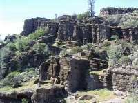
Frog Lake is a little reservoir with a few dead trees sticking out of it. I think this was the smallest lake we’ve been to at the park (not counting the small water ponds that are so valuable in the summer). From here, we hiked up to Middle Ridge and headed east. This trail alternates between open oaks forest and cutting through thick brush . The Manzanita trees are truly impressive. Normally a small bush, the specimens here are full-blown trees.
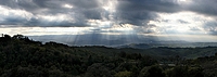
After hiking along the ridge we took a right turn and crossed the creek to start climbing back to the park headquarters. By this point, our knees were definitely starting to feel all the climbing and descending we had done, and we were ready to be back at the car. To cap off this nice springtime hike, we had the most beautiful clouds over Gilroy on the drive home. The sunbeams shooting through the clouds were beautiful, and lasted for quite a long time.
More Pictures
I’ve been trying Google Spreadsheets for tracking exercise & training this summer and it has worked out really well. They are really simple, provide just enough charting ability, and can be shared. That last bit is really helpful if you’re training for an event with a friend. You can also embed your training graphs on your website. I’ll show you how I set up a couple different shared spreadsheets for different goals.
Biking to Work
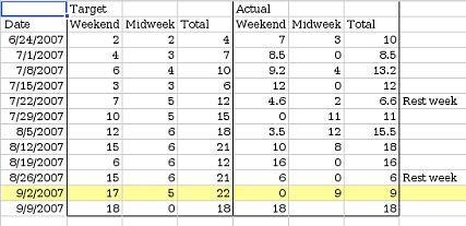
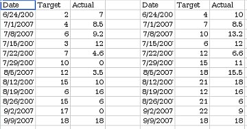
First, a fairly simple one: Yana and I set a personal goal to ride our bikes to work 40 times this quarter. This works out to a little over 3 days per week, average. I wanted a simple chart of our progress, so I made a table with 6 columns: Mark, Yana, Date, Target, Mark’s Total, and Yana’s Total. The first two columns are for entering data, the last 4 columns calculate the data for the chart. I intentionally didn’t put the Date column first. Google Spreadsheet can only graph contiguous data, so I needed to keep the date column next to the target & totals.

The first two columns track how many days we each rode that week (1 row per week). Each day we rode, we would manually increase the count for the current week. I made their background yellow to make it more obvious where to enter new data.
The target column shows our goal on the chart so we can see how we are doing. The last two columns calculate running totals (simply a matter of adding this weeks values to last week’s totals). I charted the last 4 columns (C1:F14) using a line chart with dots, with both Row 1 and Column C as labels.

You can see that we started the quarter a little bit behind but we caught up 3 weeks ago. You can view the final spreadsheet here.
Training for a Long Hike
Last weekend, Yana and I hiked Half Dome with some friends. It’s a fairly strenuous hike: 18 miles round trip, 5000 feet of climbing at elevation. We’ve done this hike before, but this year we decided we try to semi-seriously train for it, to see if it made it easier. We started training 12 weeks before the hike with a pretty simple training plan: do a long hike on the weekends with 1 or 2 short hikes mid-week, increasing the total mileage by about 3 miles per week.
Again, I set the spreadsheet up with 1 row/week. I entered target mileages and set up an area where we could enter our actual mileages. I set up 2 charts this time: One showing our longest hike every week, and one showing our total mileage every week. Rather than trying to arrange the data I wanted to chart contiguously, I just made a 2nd sheet with formulas to rearrange the data into something more chart-friendly.

I shared this spreadsheet with our friends and updated it after every training hike (you can view it here). As you can see, we didn’t stick very closely to our training plan. It turns out hiking this much eats up a lot of time, and there were some weekends where we just couldn’t fit in a long hike. However, we still got quite a bit of training, and managed to fit a 16 mile hike in 3 weeks before Half Dome. Seeing our actual mileage so far below the target mileage provided good motivation to go for training hikes. The hike up Half Dome went really well: we were faster than last time, and had more energy at the end of the hike.
Piaw, an avid bicyclist at work, led a moonlit bike ride up Mt. Hamilton last Sunday.
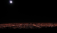 It was incredible. We started at 3 AM, so the first part of the climb offered views of the moon high over San Jose. The air was cool, a nice temperature for climbing. After gaining the ridge we left the lights of San Jose behind and rode on through the darkness, past grassy hills and scattered oaks. The road twists through two valleys, and as we dropped into each low spot, we sped through the icy cold air that had settled there, before reaching the warmer air on the other side. The black sky slowly gave way to a dark blue, the moon seemed to get larger as it set over the Santa Cruz mountains. Coming around the last corner before the top we could finally see out to the eastern horizon which was glowing the pre-dawn colors. As the sun came up we watched the light flow out over the sleeping hills below. After eating breakfast with Piaw’s friend (who graciously got up to serve us in her house) we rode back down through the bright sunlight and rapidly warming air.
The ride, in a few photos.
The ride, as a GPS track (.gpx format)
The ride, by the numbers:
- Start time: 3 AM
- Number of riders: 5 to 9 (some started later)
- Total Distance: 34.8 miles
- Total climbing: 3814 feet
- Time to the top: 3 hours
- Total time (including breakfast): 6 hours
- Number of flat tires: 4
 That’s right: 4 flats between the different riders. After about 15 minutes of climbing I stopped to take a picture and when I got back on my bike to catch up to the group, I had a flat tire. This was rather demoralizing, so early in the ride, in the dark, alone. When I finally caught up with them, they were stopped changing another flat, so I didn’t feel so bad. When a third rider got a flat 10 minutes down the road, it started being ridiculous, and by the fourth flat we were counting our spare tubes. We finally got caught by some riders who started later, and they told us that the side of the road where we had parked was covered with goathead thorns. We carefully checked our tires (found 1 thorn in Yana’s tire that hadn’t punctured it yet) and that was the end of the flats.
This ride was easier than we expected. The weekend before the ride, Yana and I weren’t sure we could do it, so we went out and rode Moody/Page Mill. Surprisingly, the longer Mt. Hamilton turned out to be easier. I think this was primarily because Mt. Hamilton has a shallower grade. Page Mill is steep enough that I really had to push to keep moving, while on Mt. Hamilton I was able to keep a comfortable cadence (and lower heart rate).
Lessons learned:
- It is easy to miss thorns in the dark. Double-check your tires before you start, and stay on the pavement.
- Patches don’t take much space, make sure you have lots (in case you miss the thorns in the dark…).
- Helmet-mounted headlamps are very helpful for changing flats in the dark.
- Don’t push on the last mile of climb when there’s still some climbing on the ride back.
- Slope is more important than distance in determining how hard a ride is.
- My eTrex GPS doesn’t save tracks at full resolution, it simplifies them first. I will get a better track by pulling the active log rather than a saved track.
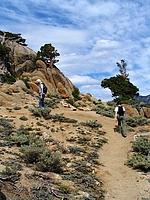
We went camping last weekend, up near Lake Alpine. We went up Saturday and got a campsite at Pacific Valley campground. I had wanted to drive out to Highland Lakes but the road was closed for the Death Ride. We set up camp, ate lunch, and then everyone laid around for an hour or two. Around 4 we decided to hike to Kinney lakes to go swimming. I think it is about 2 miles from Ebbetts Pass to the lakes, on a fairly level trail.
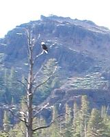
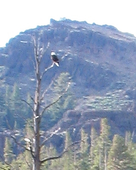
It was a little windy but the water wasn’t very cold (64° F). We hiked around the lake looking for the best possible swimming spot and right where we had started, on the southwest side. As we were getting ready to leave, we noticed some kind of large bird in a dead tree on the other side of the lake. It looks like a Bald Eagle to me, although perhaps it was just an Osprey. The lighting made it really hard to see (not having a zoom lens doesn’t help anything either).
On Sunday we broke camp and drove up to Mosquito Lake so that we could hike into Bull Run Lake. The sign said it was only 3.5 miles to the lake, but neglected to mention that there is a lot of gratuitous climbing. It was well worth it though, because the lake is gorgeous. The water is extremely clear and there is a small island in the middle of the lake. We swam out to the island and back, then ate lunch and hiked out.
More Photos
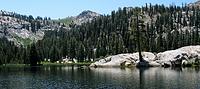
Last weekend my brother, Yana, and myself went backpacking at Noble Lake. This was the 2nd time we’d gone up to the Ebbett’s pass area (last time we went to Spicer Reservoir). I really like the area, especially Lake Alpine. Lake Alpine is simply gorgeous, and probably worth the drive all in itself.
 We hiked in Saturday and found a campsite on a hill above the main lake. It was windy during the evening, and rained a little bit so we moved camp to a lower, more sheltered spot. Sunday morning we decided we would try to climb Highland Peak before going home. We didn’t expect to make it before our self-imposed noon deadline but ended up making really good time. We followed the trail towards Bull Lake, but at the saddle turned left and climbed the ridge towards the peak, which unfortunately meant we had to climb up and over Peak 9741. Next time, I would cut straight to the saddle between Highland Peak and 9741.
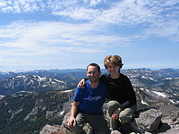
 From the 2nd saddle, there was a faint trail up the ridge to Peak 10824. Mostly class 2, with a little class 3 near the top. We ended up not going past Peak 10824. Highland Peak was probably another mile away, but only 100 feet higher, and it didn’t seem worth it. We ate lunch on top and then headed back down. There was enough loose rock near the top to run down in great sliding leaps. We made it back down to the lake by around 3 and headed home.
More Photos
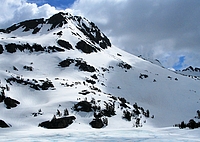
We went skiing at Carson Pass on Saturday and found some nice corn below Elephant’s Back that worked well for practicing tele turns.
After the last time I went skiing, I posted some pictures to the telemarktips.com forums and asked for advice. Everyone said “shorter poles (so you can get lower)” and several people recommended reading Paul Parker’s Free Heel Skiing. I followed both bits of advice and it worked. I was able to link turns together this time, starting to get a feel for the flow between turns. It was awesome!
More photos
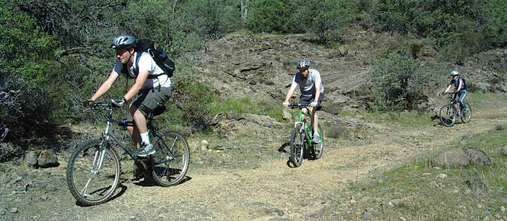
3 weeks ago my wife, brother, and I got the opportunity to mountain bike from Aetna Springs to Calistoga. This ride starts on private property but my parents obtained permission to cross through a friend of the owner.
The route follows an old wagon road which goes over the mountains between Aetna Springs and Calistoga. The road used to be used to reach the numerous mines in the area, and in some parts you can still see the ruts worn into the rock by the wagon wheels. We started a few miles past the old Aetna Springs resort, at a gate where a sign proclaimed “End of county maintained road.” From there the road goes up, skirting along the edge of a hill. The road was fairly rough on the way up and we ended up walking quite a lot of it. My parents, who were hiking, were able to keep up with us on this section of the road. The terrain in this area is very desolate and filled with odd looking volcanic rock outcroppings.
After the first main climb the road crosses a small valley before dropping down to Maple spring. Right before the road starts down there was was a small cave next to the road. The tracks from 4-wheel drive vehicles, which we had seen from the start of the ride, stopped at the cave. After that, the trail was considerably more brushy, and in most areas it was reduced from a road to a single track. In a few places we walked just to avoid touching the poison oak infringing on the trail.
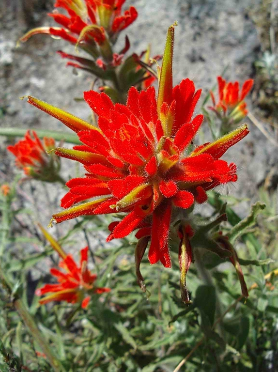
Maple spring didn’t have very much water, but it would have been enough to drink if we had been thirsty (it might have been hard to get to the water through the brush, however). From here the trail climbed up until it met the hiking trails in the Palisades area near Calistoga. There were some great wildflowers along the trail, although often the trail was technical enough that we had to stop riding if we wanted a chance to look at the flowers.
Once we met the Palisades trail, it was all downhill. The first section down is all rocks and was some of the most technical riding I have ever done. I think I walked at least half of it, and almost went over the handlebars twice. I definitely would have felt better with some body armor here. After leaving the technical rocks the trail is much nicer. There were still the occasional rocks in the trail, but after the section at the top we were ready to take them on.

This was a great ride. We probably won’t ever have the opportunity to do it again (owing to the private property at the start) but I’m glad we were able to do it once. It isn’t something I would want to do every day, however. By the time we got down our hands were aching from braking and hanging on over the bumps.
If you go snowshoeing, it might be a good idea to take a simple repair kit with you. We went cross country skiing to Fallen Leaf Lake today with my parents, who were on snowshoes. When we turned around to go back to the car we noticed one of the rivets was missing from my Dad’s snowshoe. My parents have had a few rivets pop out of their snowshoes in the past, so they were prepared when it happened again today:
Repair Kit
- A few washers
- A few small screws
- A few nuts
- A small pair of pliers
- A small screwdriver
These made the repairs simple and fast.
 The hostel is quite popular (at least during the summer months) and we were only able to get reservations for Sunday night. It was forecast to be hot in the valley on Sunday so we got up early. After meeting our friends there were some last minute gear adjustments (mounting extra water bottle cages, for example) before we departed. After leaving Sunnyvale, we rode out past Steven’s Creek reservoir, then up Montebello road. By the time we reached the climb the sun was high enough to be warm. Montebello starts out steep as it leaves the reservoir, then gets a little more gentle once it approaches the top of the ridge. When we reached the end of the pavement (Piaw likes finding dirt roads to ride on), the sun was hot. The 2-track dirt fire road goes right over the top of Black Mountain and we pedaled along, baking in the heat as we crunched through the dusty gravel. The rolling hills were covered in dry grass, being bleached by the sun. I had already finished two full bottles of water before we reached the top. Fortunately, on the other side of the peak, there’s a lonely drinking fountain next to someone’s driveway. I don’t know who the kind landowner was who provided such an oasis, but we were certainly grateful as we stopped to refill our water bottles.
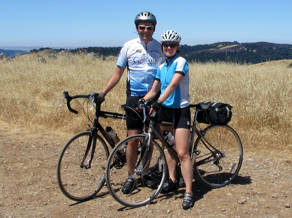 Having crossed the mountain, we had a long descent ahead of us down Alpine road. Everything was hot at this point; my brake levers and handlebars felt warm to the touch. The air was hot, and dried out our eyes as we sped down the hill. The road descended down the spine of the hill, playing with the steep ridge, first on one side of the ridge, then crossing to the other side, occasionally winding around a small hill then back to the ridge. On either side the grass-covered hill dropped away sharply and riding felt like flying as we banked around corners with the landscape far below. Each turn offered views of broad vistas when we were able to glance away from the road. It is a curse of biking that on the way up the hill you are too oxygen-starved to enjoy the view, and on the way down you are going too fast to look away from the road. (Of course, one could always ride slower, but that thought rarely occurs in the moment). About halfway down the hill the road made a sharp right turn and dropped off the ridge, plunging into the trees. It wound its way down to a creek at the bottom of the steep, wooded valley. The road here was narrow, without a centerline, and the corners were tight. After the sweeping vistas above it felt cramped, the riding no longer felt like soaring. The corners demanded attention and plenty of braking.
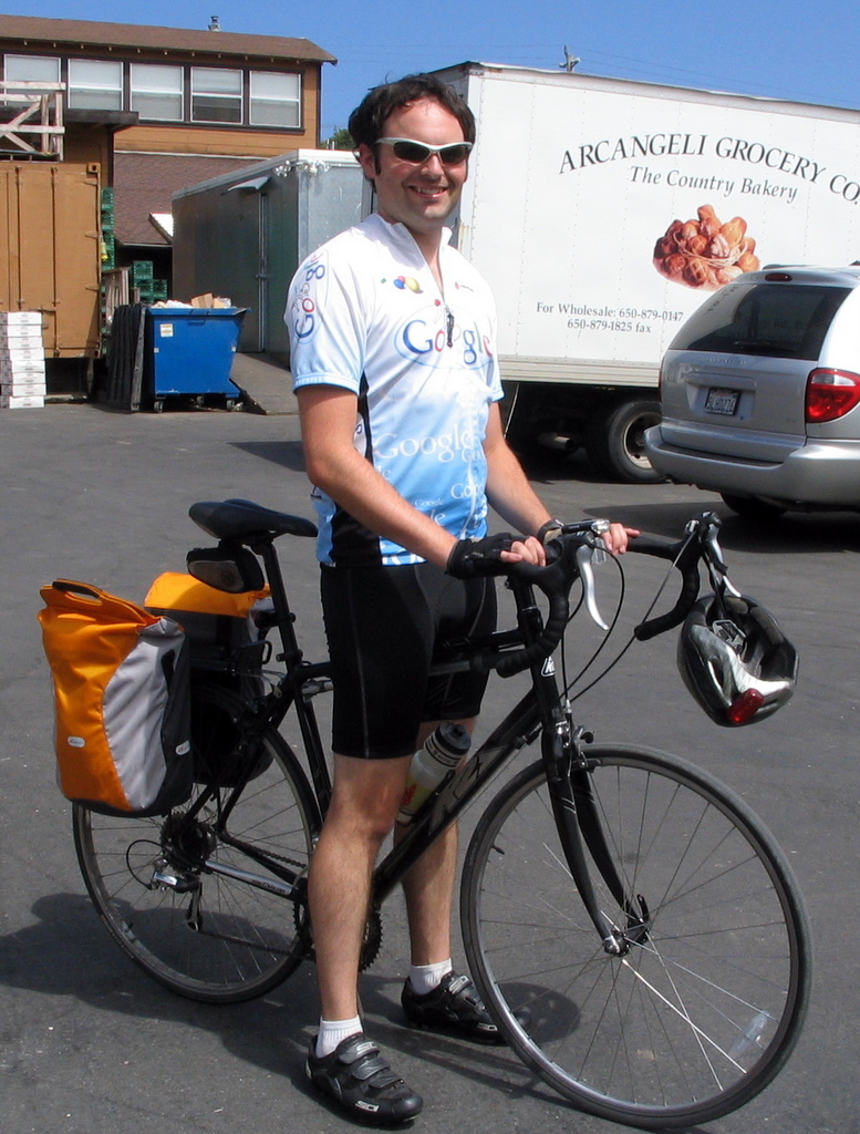 The market sells wonderful garlic artichoke bread fresh from the oven. We bought two big loaves, still warm and moist in the middle, and enjoyed them at the picnic tables on the lawn behind the store. This close to the ocean, the air was chilly and over the course of the meal we moved out from under the shade of the table’s umbrella to recline in the sun on the grass. After our meal, we returned to the store for groceries for the evening’s meal. We picked up pasta, two more loaves of half-baked bread (we would finish baking them at the hostel), and a fresh pie. All the food was stored away in saddlebags and paniers, except for the pie. It was delicate, but since Piaw and his girlfriend, Lisa, were on their tandem bike, Lisa was able to hand-carry the pie as we rode.
 It seemed a world away from the dusty, dry heat we had been in just a few hours before, only 50 miles away. We had a brisk headwind as we backtracked a few miles to the lighthouse. After checking into the hostel, I explored the beaches by foot. North of the lighthouse was a long beach being pounded by the waves and wind, but south of the lighthouse there was a quiet cove, with stairs down to it. I had brought a swimsuit, so I went in for a very (very) brief swim. Although I would have enjoyed the freezing water earlier when we were roasting in the sun on top of Black Mountain, it was much too cold now that the sun was gone. I got my head wet and then stayed out of the water until we hit the hot tub after dinner.
 Even though we had only been gone one night, I still had an odd feeling of independence as we rode in to work. It was similar to what I had felt the previous weekend, on our Point Reyes ride. There’s something about traveling by bicycle: knowing that you’re carrying whatever supplies you need and that you have the freedom to ride wherever your legs can take you.